


Collection:
Garmin
Need help choosing?


Câbles et cordons
7 produits

Marine Network network cable, large connectors, 6.1 m
Ref : 010-10551-10
Choose your option

LiveScope™ transducer extension cable (9.1 m)
Ref : 010-13350-02
Choose your option

Extension cable for LiveScope™ transducer (0.9 m)
Ref : 010-13350-01
Choose your option

USB-C power cable to bare wires
Ref : 010-13298-00
Choose your option

Garmin Cortex VHF connection cable - 2 m
Ref : 010-13269-00
Choose your option

Adapter cable for Marine Network: small (female, right-angle) to large (female)
Ref : 010-13094-00
Choose your option
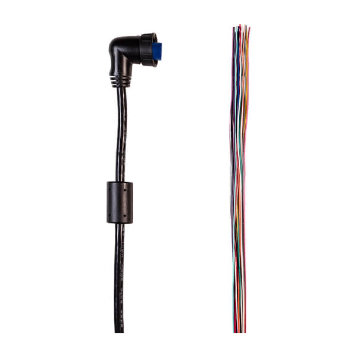
Data input/output cable (19-pin), sensor/relay output
Ref : 010-13009-04
Choose your option
Mapping
73 produits

Mexico, Caribbean to Brazil - Marine charts of coastal and inland waters
Ref : 010-C1285-20
Choose your option

Norway Marine Charts
Ref : 010-C1276-20
Choose your option

Norway Marine Charts
Ref : 010-C1276-00
Choose your option

Marine charts Europe, Central and West
Ref : 010-C1275-20
Choose your option

Marine charts Europe, Central and West
Ref : 010-C1275-00
Choose your option

Scandinavia, Southern & Northern Germany marine charts
Ref : 010-C1274-20
Choose your option

Mexico, Caribbean to Brazil - Coastal and inland water marine charts
Ref : 010-C1285-00
Choose your option

Scandinavia, Southern and Northern Germany marine charts
Ref : 010-C1274-00
Choose your option

Baltic Sea marine charts
Ref : 010-C1273-20
Choose your option

Baltic Sea Marine Charts
Ref : 010-C1273-00
Choose your option

Mediterranean and Black Sea marine charts
Ref : 010-C1272-20
Choose your option

Marine charts for Mediterranean Sea and Black Sea
Ref : 010-C1272-00
Choose your option

UK, Ireland and Netherlands marine charts
Ref : 010-C1271-20
Choose your option

UK, Ireland and Netherlands marine charts
Ref : 010-C1271-00
Choose your option

Marine charts Italy, lakes and rivers
Ref : 010-C1268-20
Choose your option

Marine charts Italy, lakes and rivers
Ref : 010-C1268-00
Choose your option

UK and Ireland inland waterways, lakes and rivers marine charts
Ref : 010-C1267-20
Choose your option

UK & Ireland inland waterway charts, lakes and rivers
Ref : 010-C1267-00
Choose your option

Norway inland waterways, lakes and rivers marine charts
Ref : 010-C1266-20
Choose your option

Norway inland water charts, lakes and rivers
Ref : 010-C1266-00
Choose your option

Sweden inland waterway charts, lakes and rivers
Ref : 010-C1262-20
Choose your option

Sweden inland waterway charts, lakes and rivers
Ref : 010-C1262-00
Choose your option

Baltic Sea, East Coast marine charts
Ref : 010-C1260-20
Choose your option

Baltic Sea, East Coast Marine Charts
Ref : 010-C1260-00
Choose your option

Inland waterways charts France, Lakes and rivers
Ref : 010-C1256-20
Choose your option

Inland waterway charts France, lakes and rivers
Ref : 010-C1256-00
Choose your option

Inland marine charts Germany, lakes and rivers
Ref : 010-C1255-20
Choose your option

Inland waterways charts Germany, lakes and rivers
Ref : 010-C1255-00
Choose your option

Inland marine charts Finland, Lakes and rivers
Ref : 010-C1254-20
Choose your option

Inland marine charts Finland, lakes and rivers
Ref : 010-C1254-00
Choose your option

Norway marine charts, from Vestfjorden to Varanger and Svalbard
Ref : 010-C1253-20
Choose your option

Norway marine charts, from Vestfjorden to Varanger and Svalbard
Ref : 010-C1253-00
Choose your option

Norway Marine Charts, From Trondheim to Tromsø
Ref : 010-C1252-20
Choose your option

Norway Marine Charts, From Trondheim to Tromsø
Ref : 010-C1252-00
Choose your option

Norway Marine Charts, from Sognefjord to Svefjorden
Ref : 010-C1251-20
Choose your option

Norway Marine Charts, from Sognefjord to Svefjorden
Ref : 010-C1251-00
Choose your option

Norway Marine Charts, From Lista to Sognefjord
Ref : 010-C1250-20
Choose your option

Norway Marine Charts, From Lista to Sognefjord
Ref : 010-C1250-00
Choose your option

Garmin Marine Charts Gulf of Finland and Riga
Ref : 010-C1249-20
Choose your option

Gulf of Finland and Riga Marine Charts
Ref : 010-C1249-00
Choose your option

Sweden, South-East Marine Charts
Ref : 010-C1247-20
Choose your option

Sweden, South-East Marine Charts
Ref : 010-C1247-00
Choose your option

Marine charts Denmark, Germany and Polish coasts
Ref : 010-C1243-20
Choose your option

Denmark, Germany and Polish coasts marine charts
Ref : 010-C1243-00
Choose your option

Benelux and Germany West marine charts
Ref : 010-C1242-20
Choose your option

Benelux and Germany West marine charts
Ref : 010-C1242-00
Choose your option

Marine charts Mediterranean Sea, Southeast
Ref : 010-C1241-20
Choose your option

Marine charts Mediterranean Sea, Southeast
Ref : 010-C1241-00
Choose your option

Marine charts Italy, Adriatic Sea
Ref : 010-C1239-20
Choose your option

Marine charts Italy, Adriatic Sea
Ref : 010-C1239-00
Choose your option

Marine charts Mediterranean Sea, central and western
Ref : 010-C1238-20
Choose your option

Merchant marine charts Mediterranean Sea, central and western
Ref : 010-C1238-00
Choose your option

Spain Marine Charts, Mediterranean Coast
Ref : 010-C1237-20
Choose your option

Marine charts Spain, Mediterranean coast
Ref : 010-C1237-00
Choose your option

Portugal and Spain Marine Charts, Northwest
Ref : 010-C1236-20
Choose your option

Golfe de Gascogne marine charts
Ref : 010-C1235-00
Choose your option

Irish Marine Charts, West Coast
Ref : 010-C1233-20
Choose your option

Marine charts Ireland, West Coast
Ref : 010-C1233-00
Choose your option

Irish Sea Marine Charts
Ref : 010-C1232-20
Choose your option

Irish Sea marine charts
Ref : 010-C1232-00
Choose your option

Marine charts Great Britain, Northeast Coast
Ref : 010-C1231-20
Choose your option

Marine charts Great Britain, Northeast Coast
Ref : 010-C1231-00
Choose your option

Garmin VEU723L Southern Europe marine chart
Ref : 010-C1157-00
Choose your option

Garmin VEU722L BlueChart g3 Vision European Atlantic Coast Chart
Ref : 010-C1156-00
Choose your option

Garmin BlueChart® g3 HXEU061R French Inland Waters Chart
Ref : 010-C1104-20
Choose your option

Garmin VEU457S Brittany marine chart
Ref : 010-C0801-00
Choose your option

BlueChart® g3 HXEU014R Chart Italy, Adriatic Sea
Ref : 010-C0772-20
Choose your option

BlueChart® g3 HXEU013R Chart Southwest Italy and Tunisia
Ref : 010-C0771-20
Choose your option

Garmin BlueChart® g3 HXEU012R Chart Mediterranean Central-West
Ref : 010-C0770-20
Choose your option

BlueChart® VEU012R Chart Mediterranean Central-West
Ref : 010-C0770-00
Choose your option

BlueChart® g3 HXEU010R Chart Spain, Mediterranean Coast
Ref : 010-C0768-20
Choose your option

BlueChart® VEU008R Bay of Biscay Chart
Ref : 010-C0766-00
Choose your option

BlueChart® g3 HXEU001R Chart English Channel
Ref : 010-C0760-20
Choose your option
Projector
3 produits

3-way LUX splitter for LED strips and Neon Flex 6-core
Ref : 010-14466-00
Choose your option

2-way LUX splitter for LED strips and 6-core Neon Flex
Ref : 010-14465-00
Choose your option

EOS SMX153/4 TIX403/4, 3 m lighting extension cable
Ref : 010-14464-00
Choose your option
Through-hull lights
1 produit

TIX802/3/4, Delrin bushing kit
Ref : 010-14451-00
Choose your option
Battery chargers
1 produit

USB-C Power Adapter
Ref : 010-13304-05
Choose your option
Alarmes de sécurité
1 produit

Garmin Cortex® external alarm kit and silent button
Ref : 010-13274-10
Choose your option
Sensors
3 produits

Garmin OnDeck™ wired shore power sensor
Ref : 010-13009-08
Choose your option

OnDeck™ Safety Sensor
Ref : 010-13009-03
Choose your option

Garmin OnDeck shore power sensor, AC power input
Ref : 010-13009-00
Choose your option
Pollsters
1 produit

OnDeck™ Temperature Sensor
Ref : 010-13009-02
Choose your option
Equipment support
30 produits

Replacement depth sounder kit for Force® and Force® Pro, without protective cone
Ref : 010-13915-10
Choose your option

Magnetic protection cover, Compatible with GPSMAP 9x17 chartplotters
Ref : 010-13901-12
Choose your option
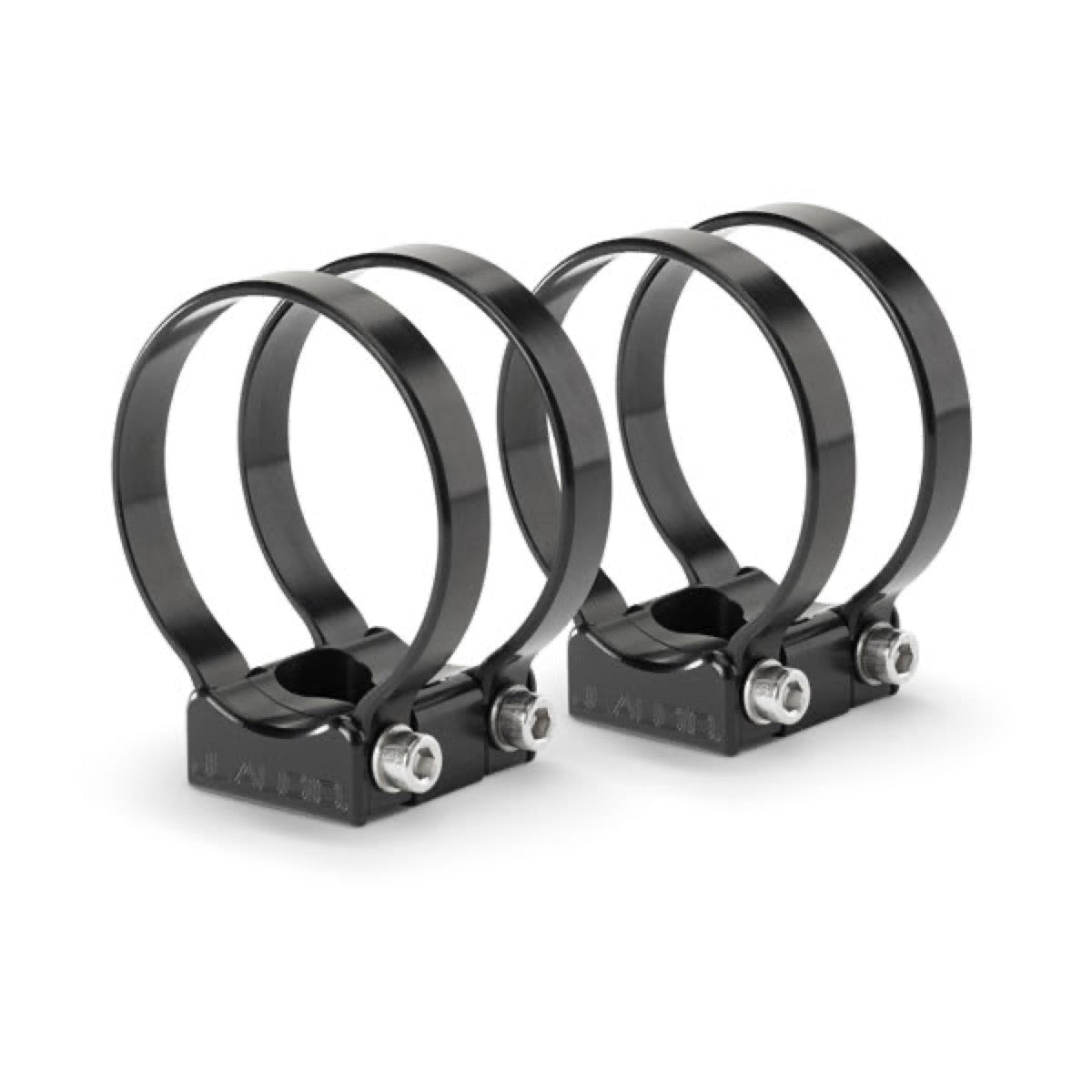
JL Audio mounting kit (93708)
Ref : 010-13875-00
Choose your option

CMC-USBCHG/2X-PNL, dual flush-mounted USB charging port
Ref : 010-13570-00
Choose your option

Mounting bracket with quick-release base (Garmin ECHOMAP™ Ultra 2 12sv series)
Ref : 010-13353-03
Choose your option

16" flush-mount kit
Ref : 010-13352-13
Choose your option

Protection cover for ECHOMAP™ Ultra 2 16-inch
Ref : 010-13352-10
Choose your option

Mounting bracket with quick-release base (Garmin ECHOMAP™ Ultra 2 10sv series)
Ref : 010-13352-02
Choose your option

Protection cover for ECHOMAP™ Ultra 2 10-inch
Ref : 010-13352-00
Choose your option

Powered mounting bracket
Ref : 010-13351-03
Choose your option

Traction rope kit with cleat
Ref : 010-13307-30
Choose your option

Garmin Cortex® H1 bulkhead mounting kit
Ref : 010-13270-00
Choose your option

Electric motor barrel mount
Ref : 010-13248-01
Choose your option

Perspective support mode
Ref : 010-13248-00
Choose your option

Magnetic protection cover for GPSMAP 9x27
Ref : 010-13209-03
Choose your option

Magnetic protective cover for GPSMAP 9x24
Ref : 010-13209-02
Choose your option

Magnetic protective cover for GPSMAP® 9x22
Ref : 010-13209-01
Choose your option

Magnetic protective cover for GPSMAP® 9x19
Ref : 010-13209-00
Choose your option

Protective cover for STRIKER / STRIKER Vivid 5-inch
Ref : 010-13130-00
Choose your option

Protective cover for STRIKER Plus / STRIKER Vivid 4-inch unit
Ref : 010-13129-00
Choose your option

Protective cover for STRIKER 4-inch fishfinder
Ref : 010-13128-00
Choose your option

Protective cover for ECHOMAP Plus/UHD 7-inch displays
Ref : 010-13126-00
Choose your option

Protection cover for ECHOMAP™ UHD2 9sv
Ref : 010-13116-04
Choose your option

Protection cover for ECHOMAP™ UHD2 7sv
Ref : 010-13116-03
Choose your option

Protection cover for ECHOMAP™ UHD2 6sv
Ref : 010-13116-02
Choose your option

Protection cover for ECHOMAP™ UHD2 7cv
Ref : 010-13116-01
Choose your option

Protection cover for ECHOMAP™ UHD2 5cv
Ref : 010-13116-00
Choose your option

Mounting bracket with quick-release base, ECHOMAP™ UHD2 9sv
Ref : 010-13115-12
Choose your option

Bracket with quick-release base for ECHOMAP™ UHD2 7sv chartplotter
Ref : 010-13115-11
Choose your option

Fast-release mounting bracket with base, ECHOMAP™ UHD2 6sv
Ref : 010-13115-10
Choose your option
Chargement des autres produits...
Learn more
Garmin: Global Leader in Marine GPS Electronics
Garmin, a major global player in GPS technology and marine electronics, offers a complete range of chartplotters, fishfinders, radars, autopilots, AIS systems, instruments, and cameras. Known for its intuitive user interfaces, integrated ecosystems, and proven reliability, Garmin’s marine lineup equips both recreational sailors and professionals. Skysat specializes in integrating Garmin systems to create high-performance, scalable bridge architectures.
Chartplotters and Navigation
Garmin chartplotters provide intuitive navigation with detailed mapping, high-resolution displays, and full integration of marine data. These systems form the core of modern electronic bridges.
- GPSMAP series: Multifunction chartplotters with high-definition touchscreens (7" to 24"). Radar, sonar, camera, and NMEA 2000 network integration. Compatible with Navionics, C-MAP, and BlueChart g3 cartography.
- ECHOMAP series: Combined chartplotter-fishfinder units with integrated CHIRP sonar. Ideal for fishing and coastal navigation, with preloaded mapping and wireless connectivity.
- ActiveCaptain features: Mobile app for route planning, automatic synchronization, smart notifications, and waypoint sharing.
Fishfinders and Sonars
Garmin offers advanced fishfinding solutions combining traditional CHIRP technology, side imaging, and forward sonar for a complete underwater view.
- Traditional CHIRP: High-power CHIRP technology for precise fish and structure detection to great depths. Multiple frequencies (50/77/83/200 kHz) for optimized performance based on conditions.
- ClearVü and SideVü: High-resolution imaging for photographic views of the seabed and side structures. Accurate identification of wrecks, seagrass beds, and fishing zones.
- Panoptix LiveScope: Real-time sonar with forward, aft, and down scanning. Live visualization of fish and structures with instant updates.
Radars and Detection
Garmin radars use digital technology to deliver superior target detection, automatic sea and rain clutter filtering, and seamless integration with chartplotters.
- GMR Fantom series: Solid-state rotating-antenna radars with adjustable power (18W to 50W). Instant-on detection, range up to 96 nautical miles, and MotionScope mode for identifying moving targets.
- Compact domes: 18" and 24" radars for small to medium-sized boats. Simplified installation and direct 12V power supply.
- Open-array antennas: 4' and 6' radars for professional vessels requiring extended range and maximum discrimination.
Autopilots and Controls
Garmin autopilot systems ensure precise heading, reduce fatigue on offshore passages, and integrate with chartplotters for automatic route following.
- Reactor series: 9-axis solid-state heading sensors with roll and pitch compensation. Heading accuracy within 1°. Compatible with hydraulic, mechanical, and outboard motor transmissions.
- GHP series: Integrated autopilot systems for yachts and professional vessels. Control of hydraulic pump or electric actuator with optional redundancy.
- Shadow Drive: Mechanical clutch enabling instant disengagement of the autopilot for manual helm takeover.
AIS and Connectivity
Garmin offers AIS transponders and network connectivity solutions for full equipment integration and real-time data sharing.
- AIS 800 and AIS 600: Class B SOTDMA transponders with automatic transmit/receive. Display of surrounding vessels directly on the chartplotter with detailed information (name, heading, speed, CPA/TCPA).
- NMEA 2000 network: Certified backbone for interconnecting instruments, sensors, and displays. Plug-and-play with automatic device detection.
- Garmin Marine Network: High-speed Ethernet network for sharing radar, sonar, and video across multiple multifunction displays.
💡 Skysat’s tip
For optimal integration of the Garmin ecosystem, design a network architecture combining NMEA 2000 for sensors and instruments, and Garmin Marine Network for high-speed data sharing (radar, sonar, video). Ensure the NMEA 2000 backbone is properly sized with termination resistors and dedicated power supply to avoid communication losses. Regular firmware updates ensure access to the latest features and fixes.


